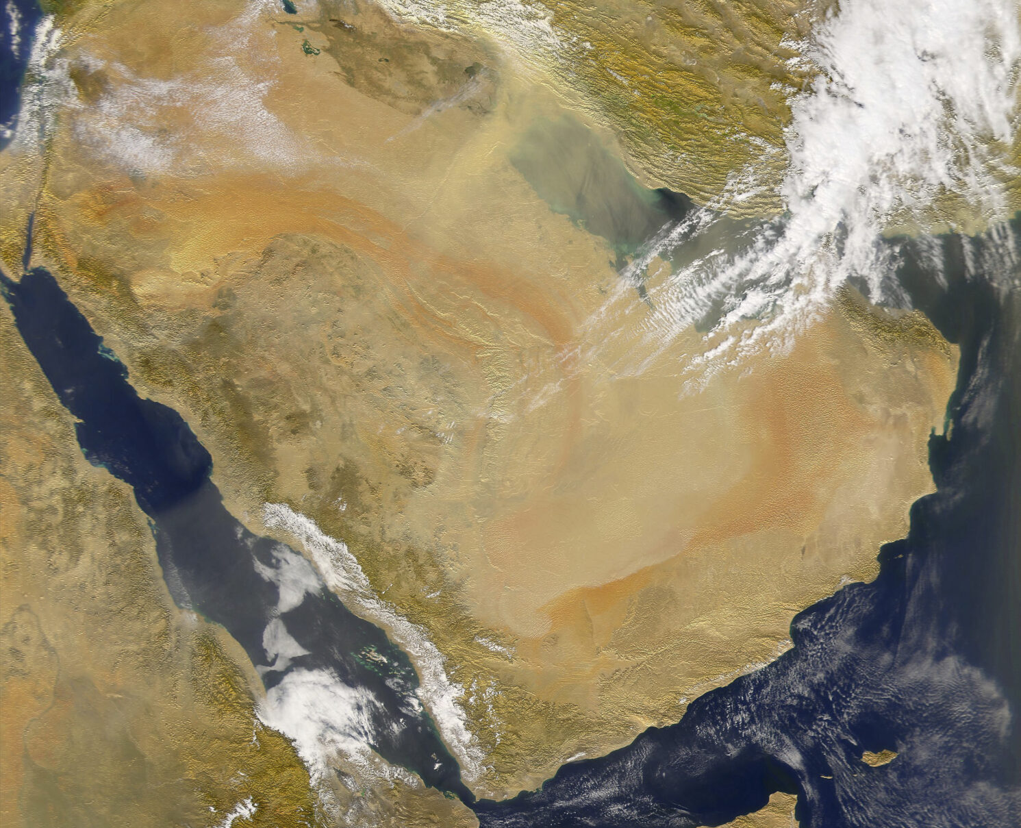
Every day, thousands of satellites pass through the sky over Saudi Arabia and most countries. The global number of satellites in orbit has surged from just over 2,000 in 2019 to almost 10,000 in mid-2024. Among these are dozens of satellites equipped with sensors capable of detecting sunlight scattered back to space by Earth’s surface and atmosphere.
“Satellite-borne sensors can detect the unique spectral signature of methane emissions generated from a facility or urban area,” says Abdel Rahman Muhsen, director of GIS Solutions at Saudi Arabia’s King Abdullah Petroleum Studies and Research Center (KAPSARC). “These satellites pass over Saudi Arabia every day, and so can provide transparent and near-real-time measurements of methane emissions in a non-intrusive and cost-effective way, even for sites that are remote or difficult to access.”
One of the core goals of the 2015 Paris Agreement is achieving year-on-year reductions in emissions of greenhouse gases (GHGs), such as CO2 and methane. While direct measures like lowering industrial emissions and expanding systainable power generation can be implemented at the source, it has proven challenging to measure the overall emissions accurately at the country scale to gauge progress. With all countries required to submit detailed national inventories of GHGs under guidelines developed by the Intergovernmental Panel on Climate Change, finding ways to estimate emissions that all nations, including less developed ones, can achieve has become increasingly crucial.
“Satellite technology will greatly increase the accuracy of methane emission estimates for many countries using publicly available data, which will help inform policymakers to design more effective policies and take more effective actions, meeting global climate and sustainability goals.”
“Estimating methane emissions is particularly challenging, which has led to wildly diverging emission estimates,” says Anwar Gasim, a climate and sustainability researcher from KAPSARC. “Without good information on the level of GHG emissions, decision-makers cannot take effective action to meet climate goals,” says Gasim, whose team has been working on a study into whether new satellite technology can be used to measure methane emissions and help explain the highly divergent estimates for Saudi Arabia.
From calculations to observations
Most countries and organizations estimate emissions using an activity-based method, where aggregate data, such as gasoline consumption, is used to calculate emissions estimates based on a standard emission factor. For example, the standard factor used for gasoline is 2.3 kilograms of CO2 produced per liter of gasoline burned. While not perfect, such calculations are backed by a lot of research and due to the similarity of gasoline combustion characteristics across uses, the potential error range in the estimate is minimal.
However, for more variable sources, such as waste and oil and gas production, emission factors can vary widely and no standard factor will fit every country, industry, or even specific locations.
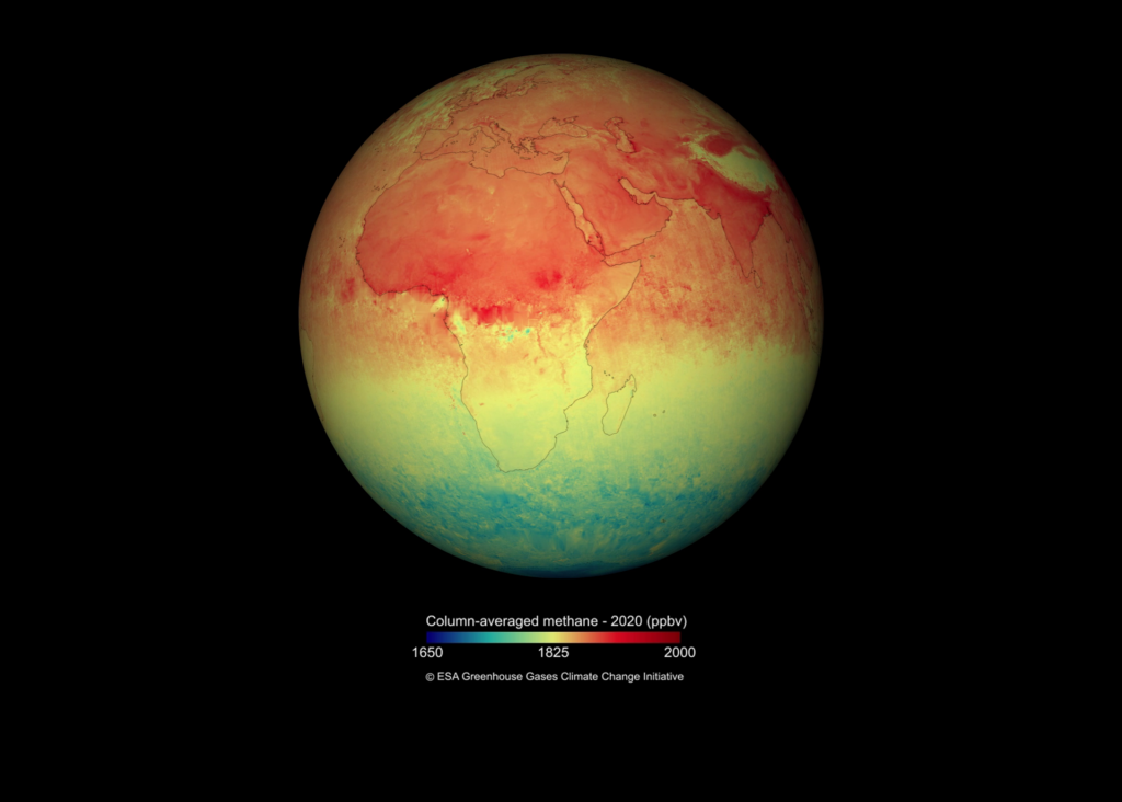
Data from the Copernicus Sentinel-5P satellite shows global methane concentration in the atmosphere in 2020. Image credit: Stocktrek Images/Getty Images
“In the case of methane emissions from oil and gas production, factors can diverge drastically from country to country or even facility to facility, and using incorrect emission factors can lead to very large differences in emission estimates, which is what we have seen for Saudi Arabia,” says Walid Matar from the KAPSARC research team.
Given that methane has 28 times the greenhouse-causing potential of CO2, these differences are significant and crucial when determining the best strategies to tackle emissions at the source. For Saudi Arabia, for instance, calculated emission estimates from oil and gas are anywhere from as high as 3 million tons to as low as low as 0.4 million tons per year. Without precise data on where, when, and how much of these emissions are produced, an accurate count cannot be confirmed.
“Most countries are currently using the 2006 IPCC guidelines to estimate and report their emissions. It was updated in 2019, but still relies on the activity-based method,” says Gasim. “Since 2019, satellite technology has developed significantly as a promising remote-sensing method with the potential to provide accurate emission data on a weekly or even daily basis.”
KAPSARC’s study used publicly available data from the Copernicus Sentinel-5P satellite launched by the European Space Agency in 2017, which captures a full global map of emissions every day, the Sentinel-2, and NASA’s EMIT sensor onboard the International Space Station. The latter can provide emission estimates at resolutions as small as 20 meters on the ground, but pass over the area of interest less frequently, from every few days to once a week.
Getting clarity on methane emissions
By combining data from these different satellites, the researchers were able to better understand the pattern of methane emissions from different sources and areas in Saudi Arabia between 2019 and 2022. This involved extracting gaseous plumes detected by the satellite-borne methane sensors from the satellite images of areas of interest, and converting the plume images into quantifiable methane amounts. Emissions in the intervals between satellite passes were interpolated, while emissions for other known sources were extrapolated based on similarity with observed source areas.
The results paint a different picture of methane emissions than estimated by any of the previous activity-based methods, and highlight the inconsistency of their calculations.
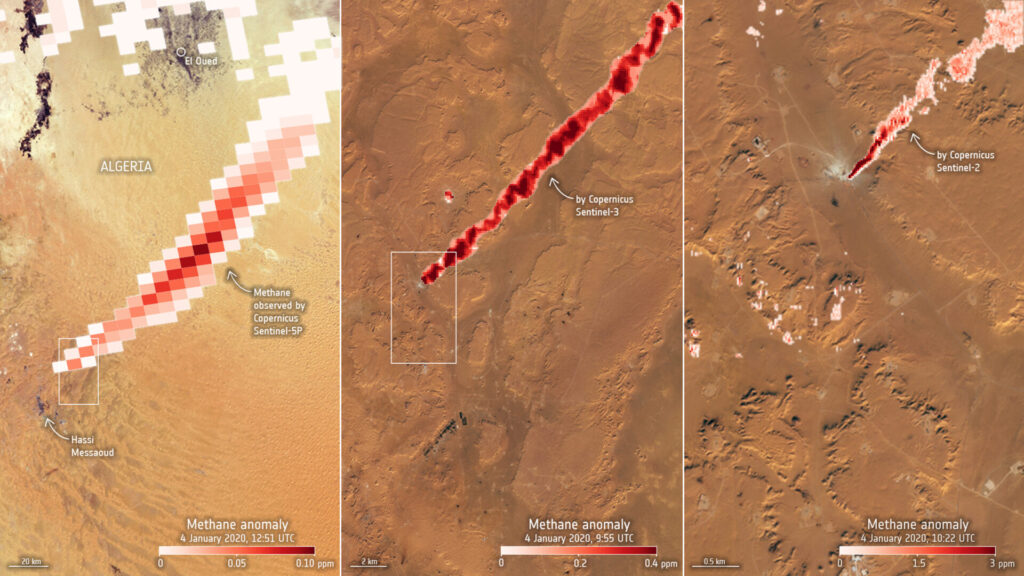
While the International Energy Agency and the European Commission’s Emissions Database for Global Atmospheric Research calculated methane emissions from oil and gas to be around 3 million tons per year and making up around two-thirds of the country’s methane emissions, KAPSARC’s satellite-based calculations estimate oil and gas emission to be less than 1 million tons per year and comprise about a quarter of total methane emissions. The findings show that urban, waste, and agricultural industries remain the major contributors to methane emissions and must be addressed in any emissions reduction strategy.
“The IPCC guidelines mention satellites as an early-stage technology with potential for measuring emissions, but satellite technology has progressed so quickly that is now a promising solution that offers high levels of data transparency and the ability for near-real-time emissions measurements,” says Gasim. “Satellite technology will greatly increase the accuracy of methane emission estimates for many countries using publicly available data, which will help inform policymakers to design more effective policies and take more effective actions, meeting global climate and sustainability goals.”
Reference
1. Gasim, A., Matar, W. and Muhsen, A. Using satellite technology to measure greenhouse gas emissions in Saudi Arabia. KAPSARC Discussion Paper (2023). | Article

